Elevated Fire Weather Conditions for Western SD
Red Flag Warnings are in effect for much of western SD today with a Fire Weather Watch in effect for tomorrow. These will be borderline critical weather events but considering the fuels conditions, it's definitely something to keep your eye on.
Today's RH:

Today's wind speeds:

The relative humidity (RH) will drop to critical levels today with minimums in the 10-15% range across much of SD. Winds will be borderline critical but should gust in the 15-25 mph range over much of western SD with some gusts near 30 in Harding/Butte Counties, as well as in the "pinch" area along I-90 in the vicinity of Rapid City. Winds will be out of the northwest and this wind direction can allow the winds locally accelerate around the Black Hills near Rapid City. It's a subtle thing but a very important thing to fire managers if a fire breaks out in that area. High temperatures today (not shown) will generally be in the mid-80s to mid-90s.
Another thing to pay attention to is the very poor RH recovery expected overnight tonight. Below is the graphic from the NWS but I honestly think these values might be too high: RHs from 15-25% might be the best we get to overnight, especially on the east side of the Black Hills.

So take a look at tomorrow as it will be another day of elevated fire danger.
The forecast for RH tomorrow:


The RH will be lower tomorrow, most notably across southwestern SD where values might range from 7-15%. Winds speeds, however, are generally expected to be lighter and below critical thresholds. The wind will be blowing out of the west over far western SD and from the south over west-central and central SD. I think we could see a couple of gusts above 25 mph but they shouldn't persist over a widespread area for long. Temperatures (not shown) will be in the mid- to upper-90 across the affected region. Needless to say, fires will resist suppression efforts.
Recall that we are still in a drought and fuels conditions remain dry. Here is the new USDM released today:

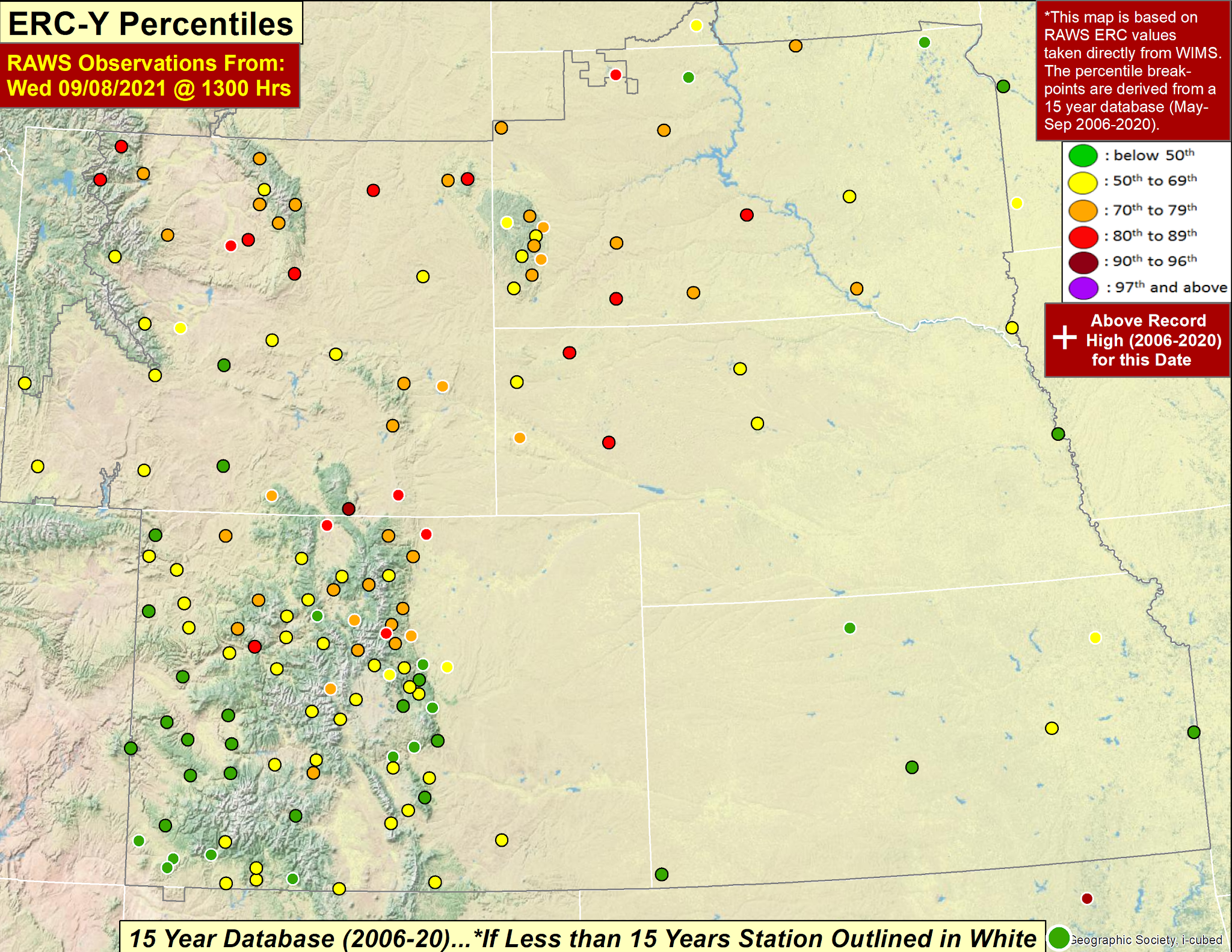
And recall ERC values are trending upwards:
Don't forget that we haven't seen any precipitation over the past 5 days which has allowed the fine fuels to completely dry back out. Here is the 5-day accumulated precipitation (since last Saturday at 0900 MDT).

All in all, this isn't an event that will lead me to scream warnings from the rooftops but it is still concerning enough. Luckily (??) there is a lot of smoke over the region which will lead to cooler temperatures that what would otherwise be expected. And this might lead to lowered max wind gusts as the vertical mixing will be less than expected. But that is a conversation for a different day.
Bonus graphics:
Today's Grassland Fire Danger Index:

And tomorrow's Grassland Fire Danger Index:

Sunday should bring some relief as light southeasterly winds spread across the state bringing higher dew points and lowering the fire danger.
No comments:
Post a Comment